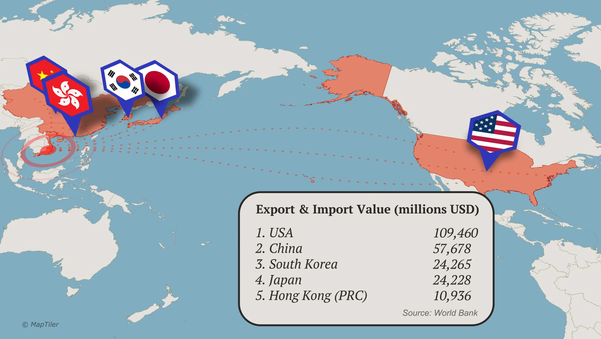
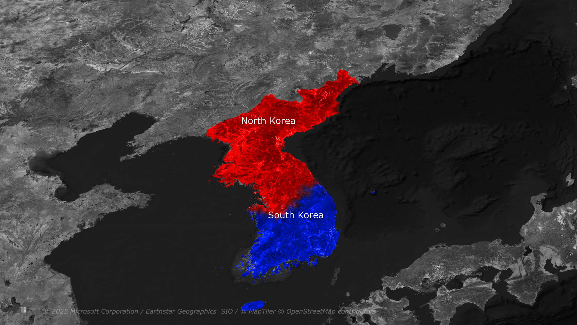
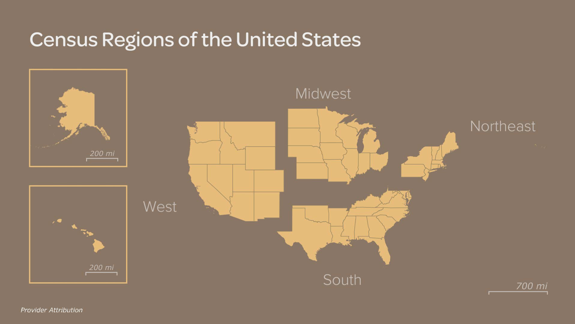
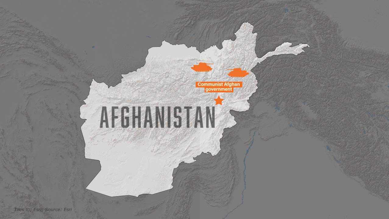
Animation: Andrew Wernette
An exercise in data-driven map graphics with countries elevated and colored relative to their respective populations, done with the GEOlayers plugin for After Effects and following a tutorial from the YouTube channel Boone Loves Video.